


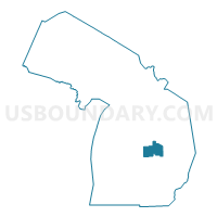
Bay & Midland Counties PUMA, Michigan
About
Outline

Summary
| Unique Area Identifier | 193159 |
| Name | Bay & Midland Counties PUMA |
| State | Michigan |
| Area (square miles) | 1,158.78 |
| Land Area (square miles) | 958.55 |
| Water Area (square miles) | 200.23 |
| % of Land Area | 82.72 |
| % of Water Area | 17.28 |
| Latitude of the Internal Point | 43.69017010 |
| Longtitude of the Internal Point | -84.14335610 |
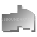
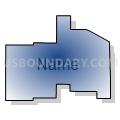
Maps

Graphs
Select a template below for downloading or customizing gragh for Bay & Midland Counties PUMA, Michigan


Neighbors
Neighoring Public Use Microdata Area (by Name) Neighboring Public Use Microdata Area on the Map
- Iosco, Gladwin, Roscommon, Ogemaw & Arenac Counties PUMA, MI
- Isabella, Gratiot & Clare Counties PUMA, MI
- Saginaw County PUMA, MI
- Tuscola, Sanilac & Huron Counties PUMA, MI
Top 10 Neighboring County (by Population) Neighboring County on the Map
- Saginaw County, MI (200,169)
- Bay County, MI (107,771)
- Midland County, MI (83,629)
- Isabella County, MI (70,311)
- Tuscola County, MI (55,729)
- Gratiot County, MI (42,476)
- Huron County, MI (33,118)
- Clare County, MI (30,926)
- Gladwin County, MI (25,692)
- Arenac County, MI (15,899)
Top 10 Neighboring County Subdivision (by Population) Neighboring County Subdivision on the Map
- Midland city, Midland County, MI (41,706)
- Bay City city, Bay County, MI (34,932)
- Bangor charter township, Bay County, MI (14,641)
- Thomas township, Saginaw County, MI (11,985)
- Monitor charter township, Bay County, MI (10,735)
- Tittabawassee township, Saginaw County, MI (9,726)
- Hampton charter township, Bay County, MI (9,652)
- Buena Vista charter township, Saginaw County, MI (8,676)
- Larkin charter township, Midland County, MI (5,136)
- Kochville township, Saginaw County, MI (5,078)
Top 10 Neighboring Place (by Population) Neighboring Place on the Map
- Midland city, MI (41,863)
- Bay City city, MI (34,932)
- Freeland CDP, MI (6,969)
- Essexville city, MI (3,478)
- Auburn city, MI (2,087)
- Pinconning city, MI (1,307)
- Coleman city, MI (1,243)
- Sanford village, MI (859)
Top 10 Neighboring Unified School District (by Population) Neighboring Unified School District on the Map
- Bay City School District, MI (72,031)
- Saginaw City School District, MI (57,759)
- Midland Public Schools, MI (53,040)
- Mount Pleasant City School District, MI (45,947)
- Bangor Township Schools, MI (14,642)
- Pinconning Area Schools, MI (11,988)
- Freeland Community School District, MI (11,914)
- St. Louis Public Schools, MI (10,971)
- Standish-Sterling Community School District, MI (10,351)
- Meridian Public Schools, MI (10,251)
Top 10 Neighboring State Legislative District Lower Chamber (by Population) Neighboring State Legislative District Lower Chamber on the Map
- State House District 99, MI (101,977)
- State House District 93, MI (98,165)
- State House District 96, MI (91,648)
- State House District 98, MI (89,740)
- State House District 94, MI (89,541)
- State House District 84, MI (88,847)
- State House District 97, MI (88,640)
- State House District 95, MI (72,851)
Top 10 Neighboring State Legislative District Upper Chamber (by Population) Neighboring State Legislative District Upper Chamber on the Map
- State Senate District 33, MI (272,940)
- State Senate District 35, MI (261,943)
- State Senate District 31, MI (255,631)
- State Senate District 36, MI (254,090)
- State Senate District 32, MI (242,645)
Top 10 Neighboring 111th Congressional District (by Population) Neighboring 111th Congressional District on the Map
- Congressional District 4, MI (686,378)
- Congressional District 1, MI (650,222)
- Congressional District 5, MI (635,129)
Top 10 Neighboring Census Tract (by Population) Neighboring Census Tract on the Map
- Census Tract 101, Saginaw County, MI (9,726)
- Census Tract 2911.02, Midland County, MI (8,977)
- Census Tract 2861, Bay County, MI (7,733)
- Census Tract 2909, Midland County, MI (7,688)
- Census Tract 2856, Bay County, MI (7,016)
- Census Tract 2855, Bay County, MI (6,693)
- Census Tract 2858, Bay County, MI (6,363)
- Census Tract 2910, Midland County, MI (6,256)
- Census Tract 2852.01, Bay County, MI (5,834)
- Census Tract 9402, Isabella County, MI (5,699)
Top 10 Neighboring 5-Digit ZIP Code Tabulation Area (by Population) Neighboring 5-Digit ZIP Code Tabulation Area on the Map
- 48858, MI (50,025)
- 48706, MI (40,596)
- 48601, MI (38,406)
- 48640, MI (32,690)
- 48642, MI (32,277)
- 48708, MI (27,262)
- 48623, MI (13,993)
- 48604, MI (13,074)
- 48732, MI (11,483)
- 48880, MI (10,669)